Severe Weather Threat For Much Of Louisiana Today
A slow moving low pressure system is currently centered over eastern Texas this morning. This system combined with an assist from the upper level winds in the atmosphere a creating a scenario for dangerous weather across much of the Bayou State today.
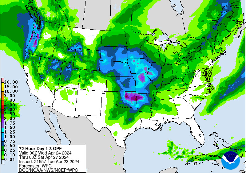
The Storm Prediction Center in Norman Oklahoma says there is a slight risk of severe storms and possible tornadoes across almost all but the extreme southeastern part of the state today. The threat of severe weather should lessen across the region tomorrow. That won't mean we will be out of the heavy weather woods so to speak. There is still a marginal threat of severe storms and heavy rains across the state on Thursday.
Donald Jones with the National Weather Service says that severe weather is certainly a possibility but the biggest threat to life and property may come in the form of flooding because the potential of some very heavy rainfall.
Wednesday and Thursday are going to be our big rain making days. We’re going to be looking at rainfall totals for that period, anywhere from 6 up to 10 inches of rain.
If you haven't noticed one thing we don't do very well in Louisiana is drain. Our topography tends to hold water for long periods of time. The low lying land and the threat of intense rainfall over a short period of time has forecasters concerned about just how much water the ground can hold before flooding becomes a serious issue.
Much of the state has been dry for the past several weeks but Jones says that should only allow a small portion of the forecast rainfall totals to soak into the ground.
But it’s when we start getting those big rainfall amounts that the real flood threat is going to begin. We’re going to be looking at not only street flooding but also the possibility of fairly significant river flooding, as well.
Jones made his comments in a story published by the Louisiana Radio Network.
More From 107 JAMZ