Tropical Cyclone Formation in Caribbean Likely By Saturday
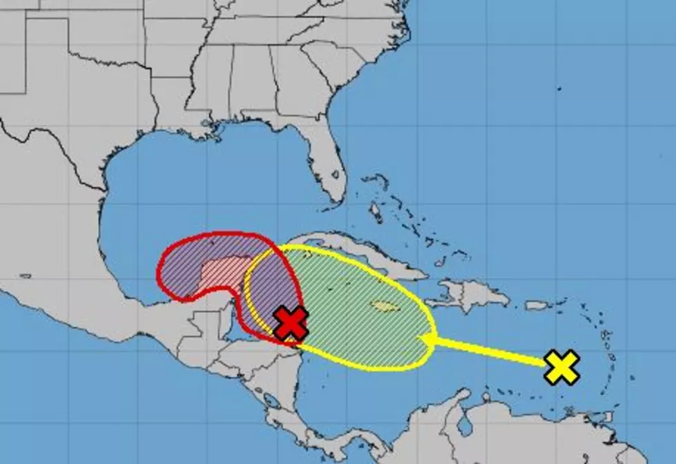
Yesterday the National Hurricane Center officially designated an area of disturbed weather in the western Caribbean Sea as Invest 91L. That designation allows forecasters to utilize a few more tools in their belt when it comes to predicting the eventual track and intensity of what could become Tropical Storm Gamma by later today or sometime during the day on Saturday.
Forecasters say that environmental conditions in and around the system will be conducive for strengthening as long as the center of the system stays over the warm waters of the Caribbean or the southern Gulf of Mexico. Based on current forecasts that does seem likely.
Tropical forecast models suggest that the system will move in the general direction of the Yucatan Peninsula. Most of the model guidance does bring the storm system onshore in Mexico. From there the weather system is expected to interact with an old frontal boundary. That front, the one that brought us the nice weather in Louisiana, is expected to be a major player in what will eventually happen with this system.
As of now, this system poses no threat to the coastline of Louisiana. However, anytime a tropical system forms in our near the Gulf of Mexico it is always prudent to stay vigilant for any changes in the forecast.
By the way, there is a second tropical wave moving through the eastern Caribbean Sea this morning too. That wave should move just south of Jamaica over the weekend and could impact the Yucatan Peninsula of Mexico by early next week. Forecasters with the National Hurricane Center are giving this system a 30% probability of strengthening over the next five days.
10 of Buc-ee's Best Snack Options for the Open Road
More From 107 JAMZ