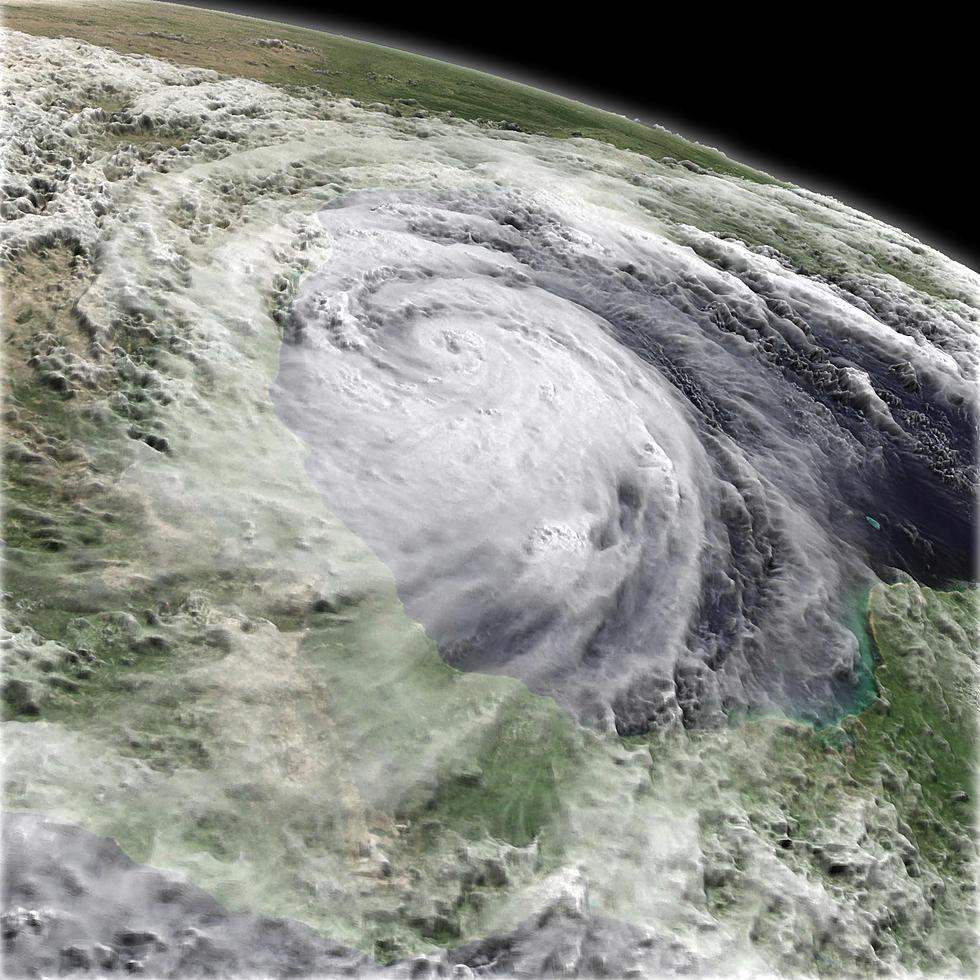
Tropical Storm Tracking Closer To SWLA
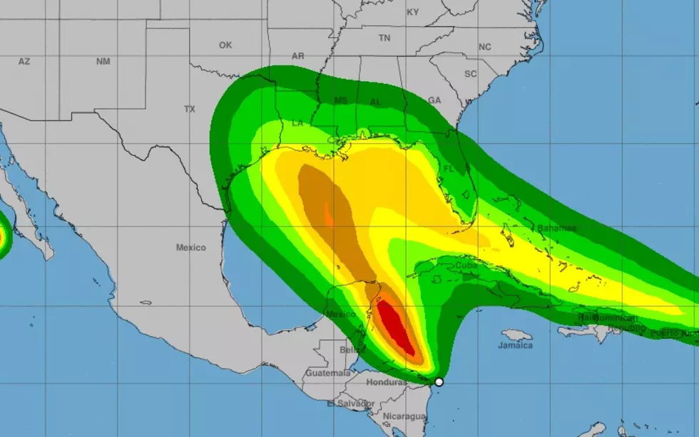
What a difference a day makes with the path of a tropical disturbance. Yesterday, Tropical Depression Fourteen was tracking to make landfall in Houston but now it's looking more like the Sabine Pass area as it inches closer to SWLA.
Currently, Tropical Depression Fourteen is moving WNW at 12mph and has 35mph sustained winds. The National Hurricane Center is expecting the disturbance to strengthen into a Tropical Storm around 8:00am this morning and be a hurricane before making landfall.
Meteorologist Zack Fradella has been on our morning show several times for his knowledge and specialization in Gulf weather. Even he's unsure how both storms in the Gulf of Mexico will affect each other. This is going to be interesting.
Here's the SWLA weather forecast leading up to landfall:
- Monday - Showers and thunderstorms likely, mainly after 1:00pm. Partly sunny, with a high near 91. East wind 5 to 10mph. Chance of precipitation is 60%.
- Monday Night - A 40 percent chance of showers and thunderstorms. Mostly cloudy, with a low around 76. Northeast wind 5 to 10mph.
- Tuesday - Showers and thunderstorms. High near 90. Windy, with a northeast wind 5 to 10mph becoming east 20 to 30mph in the afternoon. Winds could gust as high as 40mph. Chance of precipitation is 80%.
- Tuesday Night - Showers and thunderstorms. Low around 77. Windy. Chance of precipitation is 80%.
Keep it tuned to our Facebook page, live on the air, and right here on our website for all the latest information on developing weather in SWLA.

Essential Items for Your Hurricane Kit
More From 107 JAMZ